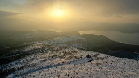

Location
Shiribeshi Area, Central Hokkaido
北海道中央部 後志地方
Date taken
08/2021
43° 17′ N, 140° 20′ E.
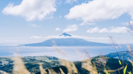
積丹半島の大規模地滑り地形
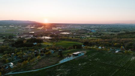
北見山地に属する標高1,446mの山。由来をアイヌ語で「チ・トカン・イ・ウシ=我ら・射る・木がある・所」と言い、狩猟を行う際にここで豊猟を願って矢を放ち、占いを行う場所であったとされる。現代に登山道は残っておらず、冬季のみ立ち入り可能。大雪山の北側、北大雪エリアと言われる場所に有り、その山頂からは旭岳を中心とした表大雪エリアが一望出来る。
Large landslide landforms on the Shakotan Peninsula.
A 1,446 m high mountain in the Kitami Mountains. The name is derived from the Ainu word ‘chi-tokan-i usi’, meaning ‘we shoot, there is a tree’, and it is said that when hunting, arrows were shot here in the hope of good hunting, and the place was used for divining good luck and bad luck. There are no trails remaining today and the area is only accessible in winter. The summit offers a panoramic view of the Kita-Daisetsu area, centred on Asahidake (Mt. Asahidake).